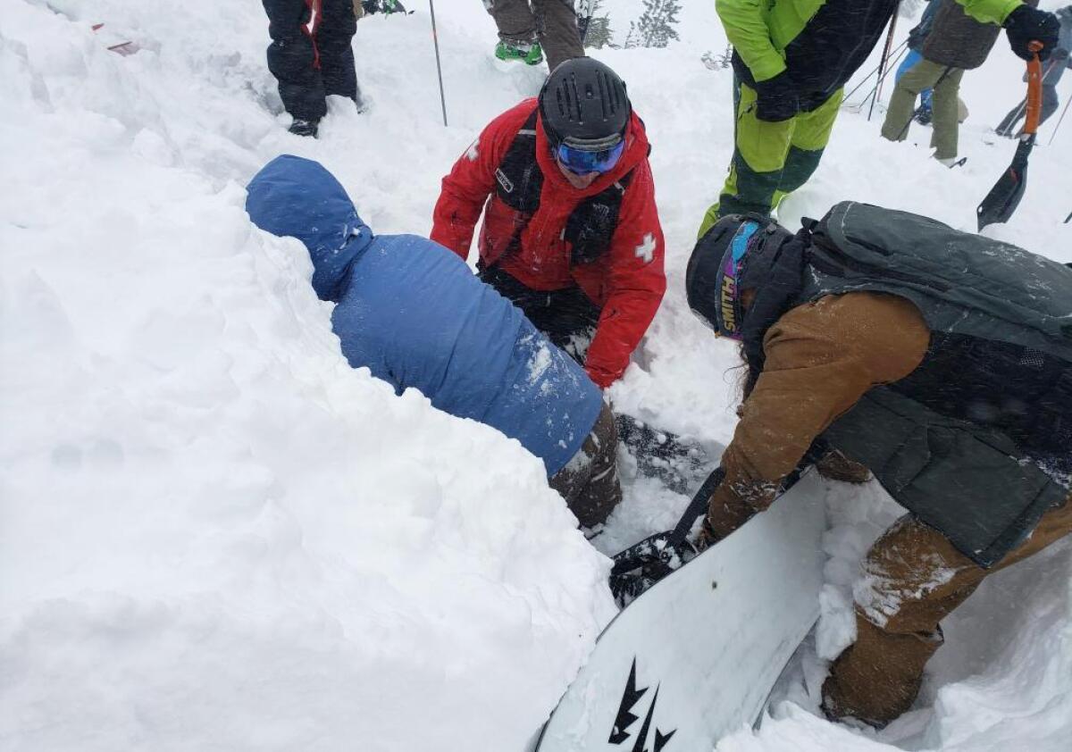
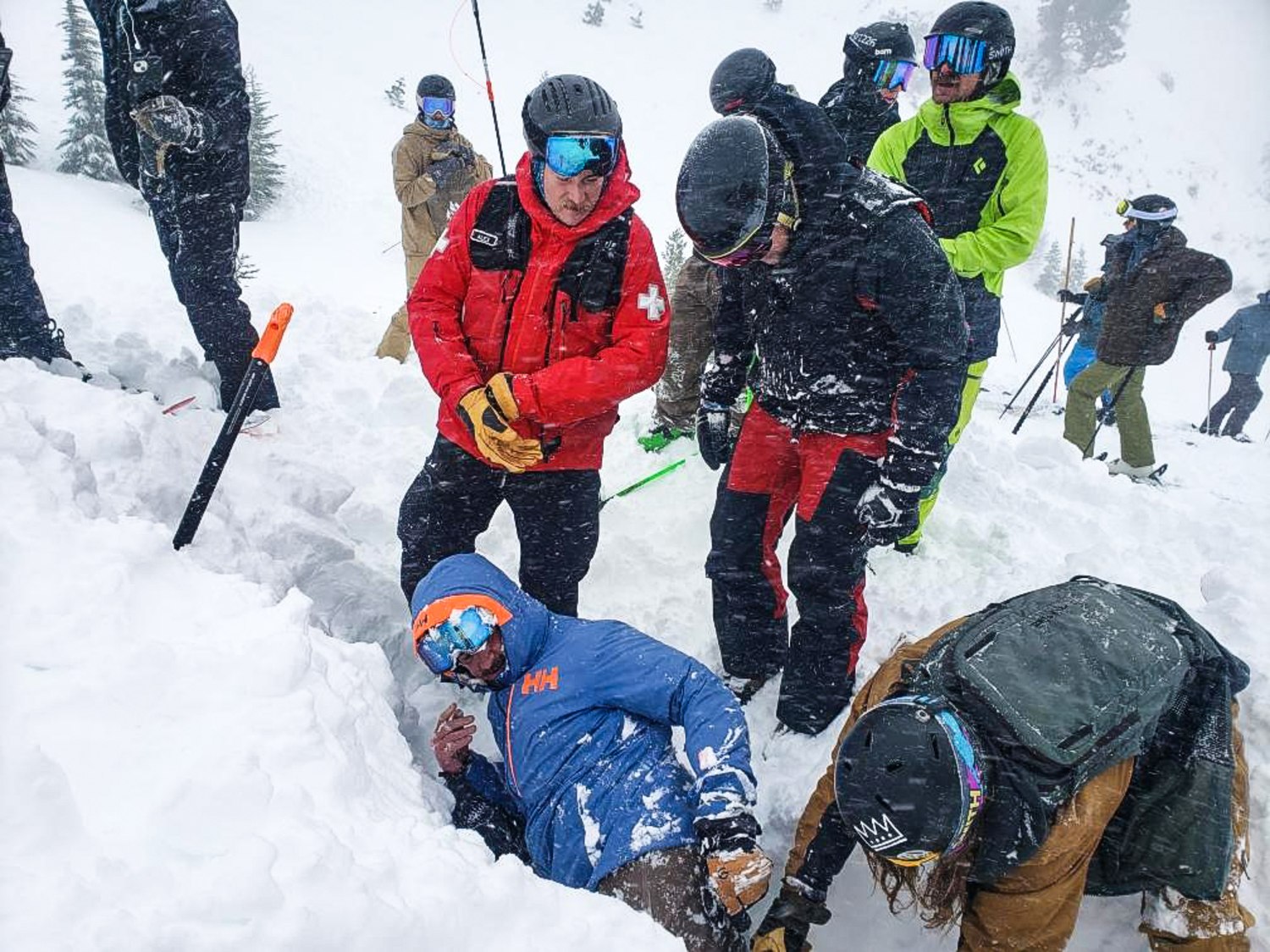
The 11 skiers and four guides hit by a deadly avalanche after leaving backcountry huts near Donner Summit appear to have taken a route out of the wilderness that includes terrain that had been rated significantly more dangerous for such slides than that of a longer, slower exit route, interviews and documents show.
Nine members of the group were confirmed or feared dead, including six women friends from the Bay Area, Tahoe and Idaho, and three employees of Blackbird Mountain Guides.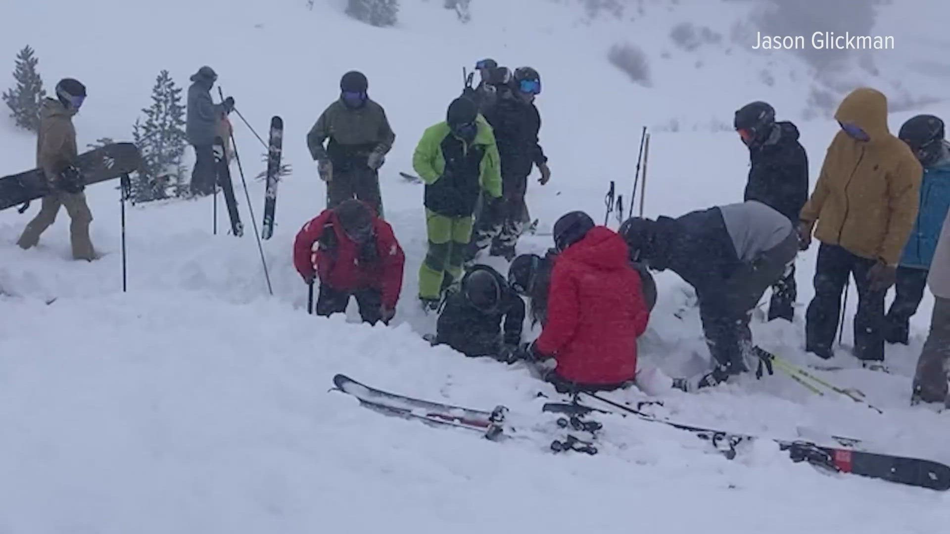
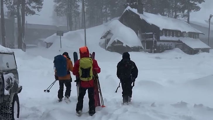
Based on the location of the disaster, it appears the group left the Frog Lake huts before noon on Tuesday and headed northwest on the Castle Peak trailhead route, which ends on the north side of Interstate 80 across from Boreal Mountain Resort. It’s unclear where the guides and clients parked their vehicles.
According to the Truckee Donner Land Trust, which owns the ski huts, that route traverses below slopes as steep as 60 degrees and is rated “complex” or “Class 3” on the Avalanche Terrain Exposure Scale, the second-most-dangerous score below “Extreme.” The scale, known as the ATES, was developed by Canada’s parks agency and is widely used in the U.S.
East of the huts, documents and maps show, is a longer, flatter route toward Johnson Canyon, rated on the land trust website as “simple” or “Class 1.” The lowest level is “Class 0,” describing “no known exposure to avalanches.”
The roughly 100-yard wide avalanche struck near the start of the group’s journey away from Frog Lake, where they had enjoyed three days of backcountry skiing before a massive storm blew in.
The Nevada County Sheriff’s Office said it was investigating why the group decided to venture into extreme weather rather than stay at the huts, and whether criminal negligence was a factor in the tragedy. As authorities sought Thursday to recover the bodies of the victims amid the continuing storm, Cal/OSHA, the state’s workplace safety agency, said it opened a separate probe into Blackbird Mountain Guides.
Family members of the group of women who died released a statement Tuesday saying they had “many unanswered questions.”
“Eight close friends planned a professionally guided, two-night backcountry hut trip to Frog Lake Huts outside Truckee, Calif.,” the statement said. “The trip had been organized well in advance. They were experienced backcountry skiers who deeply respected the mountains. They were trained and prepared for backcountry travel and trusted their professional guides on this trip. They were fully equipped with avalanche safety equipment.”
Neither the guide company nor the nonprofit land trust immediately answered questions about the routes sent by the Chronicle.
Blackbird Mountain Guides founder Zeb Blais said in a statement that “guides in the field are in communication with senior guides at our base, to discuss conditions and routing based upon conditions. There is still a lot that we’re learning about what happened. It’s too soon to draw conclusions, but investigations are underway.”
A frequent Frog Lake visitor, Jim Zellers, said in an interview that it was not clear whether the guides erred if they chose the westward route, given the limited information available so far. Ideally, the backcountry snowboarder said, a person confronted with such inclement weather would stay in the huts and wait it out, but he added that there could have been extenuating circumstances.
Which way to exit would depend on a variety of factors, he said, including the direction of the storm, the conditions of the guests and familiarity with the routes, among others.
“You cannot start judging,” said Zellers, who has visited the huts about 40 times and helped build some of its furniture. “It’s a terrible place to go. Those of us who are experienced are just sad, the less experienced are judging.”
He noted that while there’s less avalanche risk on the Johnson Canyon route, it is harder to navigate, particularly in white-out conditions and if a guide is not used to traveling that direction.
The Land Trust, which rents out the huts, hosts a page on its website dedicated to the winter routes. “All the routes listed in this guide have some degree of avalanche hazard,” the site warns.
It advises skiers to check the Avalanche Terrain Exposure Scale ratings for each route, as well as to monitor daily avalanche forecasts. The Sierra Avalanche Center issued an avalanche warning around 5 a.m. day the group left the huts.
From the huts, Castle Peak Trailhead is three and a half miles away, with 1,100 feet of ascent and 1,500 feet of descent. In the first section near what is called the Notch, avalanche terrain flanks both sides.
“Some of this avalanche terrain is commonly wind-loaded along with large cornices on the ridges,” the trust explains. The next section, below Frog Lake cliffs, includes numerous avalanche paths. “It is imperative that you have appropriate avalanche conditions to move through this terrain,” the trust says.
This trail also can send hikers to the Donner Summit rest area near the end of the return trip, but the treacherous sections are the same.
The alternative option is the 4.5-mile Johnson Canyon route to the east. In the first stages of descent, the trust says, skiers encounter some slopes, but explains they are not nearly as steep and consistent as the route to the west.
“Isolated small areas of avalanche terrain could be encountered through this section,” the trust writes, “but with careful route finding, most all avalanche terrain can be avoided with limited exposure.” The final stages of that route are mostly below the treeline and “low angle terrain,” the site adds.
The simple, Class 1 designation indicates “exposure to low angle or primarily forested terrain,” according to the American Avalanche Association. “Some forest openings may involve the runout zones of infrequent avalanches and terrain traps may exist. Many options to reduce or eliminate exposure.”
Meanwhile, the complex, Class 3 designation refers to “exposure to multiple overlapping avalanche paths or large expanses of steep, open terrain. Sustained exposure to overhead hazard. Many avalanche starting zones and terrain traps with minimal options to reduce exposure.”